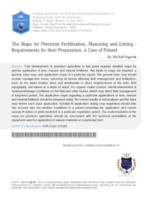
The Maps for Precision Fertilization, Manuring and Liming – Requirements for their Preparation. A Case of Poland

§ Warsaw University of Life Sciences Warsaw University of Life Sciences

Send Message

To: Author

The Maps for Precision Fertilization, Manuring and Liming – Requirements for their Preparation. A Case of Poland

Article Fingerprint

ReserarchID

GI024

The Maps for Precision Fertilization, Manuring and Liming – Requirements for their Preparation. A Case of Poland Banner

AI TAKEAWAY

Connecting with the Eternal Ground
  • English
  • Afrikaans
  • Albanian
  • Amharic
  • Arabic
  • Armenian
  • Azerbaijani
  • Basque
  • Belarusian
  • Bengali
  • Bosnian
  • Bulgarian
  • Catalan
  • Cebuano
  • Chichewa
  • Chinese (Simplified)
  • Chinese (Traditional)
  • Corsican
  • Croatian
  • Czech
  • Danish
  • Dutch
  • Esperanto
  • Estonian
  • Filipino
  • Finnish
  • French
  • Frisian
  • Galician
  • Georgian
  • German
  • Greek
  • Gujarati
  • Haitian Creole
  • Hausa
  • Hawaiian
  • Hebrew
  • Hindi
  • Hmong
  • Hungarian
  • Icelandic
  • Igbo
  • Indonesian
  • Irish
  • Italian
  • Japanese
  • Javanese
  • Kannada
  • Kazakh
  • Khmer
  • Korean
  • Kurdish (Kurmanji)
  • Kyrgyz
  • Lao
  • Latin
  • Latvian
  • Lithuanian
  • Luxembourgish
  • Macedonian
  • Malagasy
  • Malay
  • Malayalam
  • Maltese
  • Maori
  • Marathi
  • Mongolian
  • Myanmar (Burmese)
  • Nepali
  • Norwegian
  • Pashto
  • Persian
  • Polish
  • Portuguese
  • Punjabi
  • Romanian
  • Russian
  • Samoan
  • Scots Gaelic
  • Serbian
  • Sesotho
  • Shona
  • Sindhi
  • Sinhala
  • Slovak
  • Slovenian
  • Somali
  • Spanish
  • Sundanese
  • Swahili
  • Swedish
  • Tajik
  • Tamil
  • Telugu
  • Thai
  • Turkish
  • Ukrainian
  • Urdu
  • Uzbek
  • Vietnamese
  • Welsh
  • Xhosa
  • Yiddish
  • Yoruba
  • Zulu
Font Type
Font Size
Font Size
Bedground

Abstract

Fast development of precision agriculture in last years requires detailed maps for precise application of lime, manure and mineral fertilizers. Two kinds of maps are required: a general, base map, and application maps of a particular inputs. The general base map should contain management zones, resuming all factors affecting field management and fertilization, such as the water bodies, trees and windbreaks in direct neighborhood of the field, field topography, soil texture to a depth of about 1m, organic matter content, overall assessment of moisture/drainage conditions on the field and other factors, which may affect field management in long-term period. The application maps regarding a particular applications of lime, manure and mineral fertilizers should be prepared using the current results of soil analyses and the base map before each input application. Variable N application during crop vegetation should take into account also the weather conditions in a period preceding the application and current canopy N status or yield predicted in a particular vegetation period. The scale/resolution of the maps for precision agriculture should be concordant with the technical possibilities of the equipment used for application of various materials on a particular farm.

References

8 Cites in Article
  1. Anonymous (1991). Council Directive 91/689/EEC of 12 December 1991 on hazardous waste (<i>OJ L 377 31.12.1991 p. 20</i>).
  2. R Bednarek,H Dziadowiec,U Pokojska,Z Prusinkiewicz (2011). Badania ekologicznogleboznawcze.
  3. S Blackmore (2000). The interpretation of trends from multiple yield maps.
  4. Eric Brevik,Thomas Fenton,Dan Jaynes (2003). Evaluation of the Accuracy of a Central Iowa Soil Survey and Implications for Precision Soil Management.
  5. T David,J David,A Oliveira (1994). Cortinas de abrigo. Infuências na protecção e produção de culturas agrícolas.
  6. Defra (2009). Protecting our water, soil and air. A Code of Good Agricultural Practice for farmers, growers and land managers.
  7. Defra (2010). Manual on Presentation of Data and Control Chart Analysis, 8th Edition.
  8. Anna Walaszczyk,Jarosław Redzisz (2004). Implementacja Dobrej Praktyki Rolniczej, studium przypadku.

Funding

No external funding was declared for this work.

Conflict of Interest

The authors declare no conflict of interest.

Ethical Approval

No ethics committee approval was required for this article type.

Data Availability

Not applicable for this article.

How to Cite This Article

Michal Stepien. 2017. "The Maps for Precision Fertilization, Manuring and Liming – Requirements for their Preparation. A Case of Poland". Global Journal of Science Frontier Research, Global Journal of Science Frontier Research - D: Agriculture & Veterinary GJSFR-D Volume 17 (GJSFR Volume 17 Issue D1).

Download Citation

Journal Specifications

Crossref Journal DOI 10.17406/GJSFR

Print ISSN 0975-5896

e-ISSN 2249-4626

Keywords
Classification
GJSFR-D Classification FOR Code: 070302
Version of record

v1.2

Issue date
February 25, 2017

Language
English
Experiance in AR

Explore published articles in an immersive Augmented Reality environment. Our platform converts research papers into interactive 3D books, allowing readers to view and interact with content using AR and VR compatible devices.

Read in 3D

Your published article is automatically converted into a realistic 3D book. Flip through pages and read research papers in a more engaging and interactive format.

Article Matrices
Total Views: 1.6K
Total Downloads: 123
All Trends

Request Access

Please fill out the form below to request access to this research paper. Your request will be reviewed by the editorial or author team.
X

This is the heading

Lorem ipsum dolor sit amet, consectetur adipiscing elit. Ut elit tellus, luctus nec ullamcorper mattis, pulvinar dapibus leo.


High-quality academic research articles on global topics and journals.

The Maps for Precision Fertilization, Manuring and Liming – Requirements for their Preparation. A Case of Poland

Michal Stepien
Michal Stepien Warsaw University of Life Sciences