
I. INTRODUCTION
Wetlands are considered as ecological valuable resources all over the world for the potential to support a wide variety of ecosystems and their significant impact on the sustainability of the environment. Haors are the native name for these wetlands in Bangladesh, and they play an essential role to the country's economy and the survival of many people and animal species. However, the serene beauty of these watery landscapes conceals a growing and pressing concern. The sensitive equilibrium of these ecosystems is threatened by frequent travel, ignorance of environmental protection, and irresponsible development methods, threatening their important ecological functions.
In spite of these challenges, the "Haor Eco-Interpretation Center" in the beautiful area of Sylhet, Bangladesh, has emerged as a pioneering endeavor. This innovative project provides a groundbreaking example of how to comprehend and preserve Haor ecosystems by bringing together environmental education and sustainable design concepts. In the next section of the study, the many facets of this significant effort are examined, including its goals, techniques, and wider relevance in the context of wetland conservation.
The mission of the Haor Eco-Interpretation Center is to combine human progress with environmental protection. The architectural and functional components of this integration are representative of its commitment to sustainability. The importance of wetlands as ecosystems, the challenges that they confront, and the pressing need to preserve them are all emphasized as part of the tourist experience. As well as being a place where people can learn, the center is also a key research facility, helping researchers get a better knowledge of Haor ecosystems and giving them a place to share their findings and collaborate on important conservation efforts.
II. ECOSYSTEM OF HAKALUKI HAOR
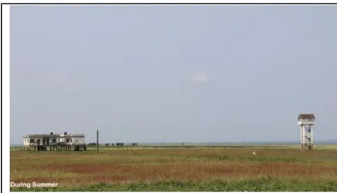
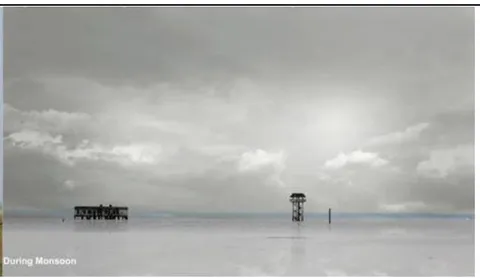
Seasonal strong winds during the monsoon period (July to September) cause enormous swelling in the haor, which can cause significant damage to farmland. However, they all become dried out following the monsoon season. These haors are extensive stretches of verdant land during the winter.
The Total Covered area of Hakaluki Haor contains different sizes and types of water bowls. According to the typology there can be three types basically in which different zone of this haor can be divided. Hakaluki Haor covers an area of 32,000 ha and it has a central elevation of (PWD), an area of about 18,000 ha, lying below the contour of , is considered Seasonal Wetlands, and during the monsoon, the entire haor is flooded and over of the area is inundated by more than , and the whole of the haor becomes a sheet of water (Figure. 02) (Hasan, M. et al. 2005).
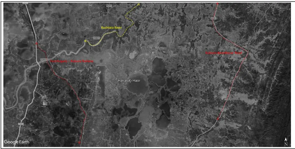
through the haor and some smaller hilly streams joining these rivers or discharging into some beels fall under the category of Perennial Wetlands.
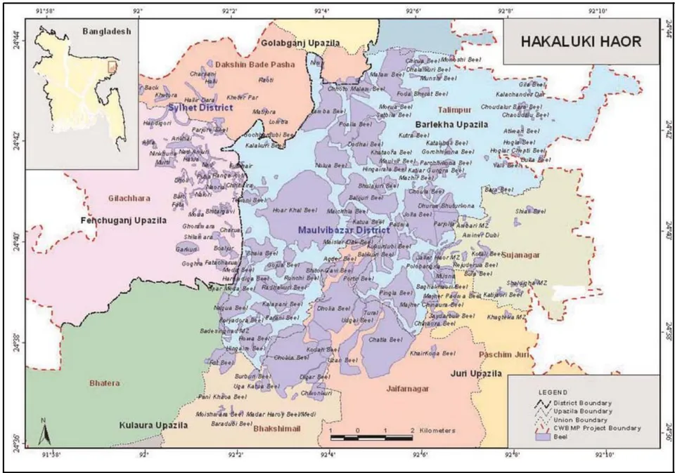
Source: https://www.researchgate.net/figure/Map-of-Hakaluki-haor-of-Bangladesh FIG1_233520655
III. SITE ATTRACTIVENESS: ELEMENTS OF INTERPRETATION
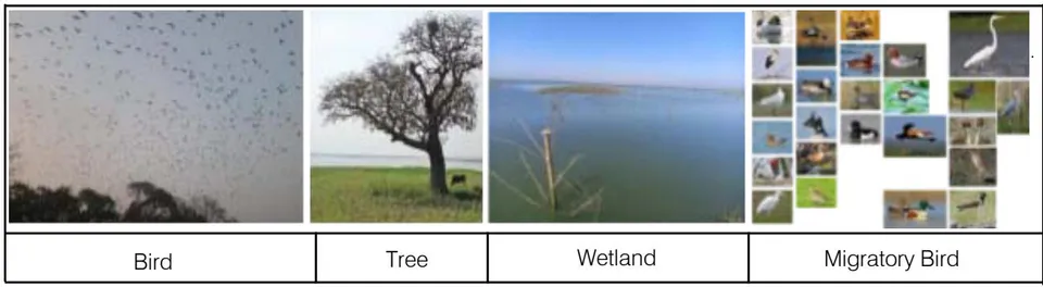
There are approximately 526 plant species in the region, including 120 aquatic plants (Steemit, 2018) that not only thrive in water but also contribute to the health of fish sanctuaries. There are 417 bird species, 112 of which are migratory and 305 that are native to the area (Steemit, 2018). There are a few hamlets around the haor, nestled within the hundreds of trees that surround the area. Many thousands of birds rest in the trees at night and feed on the haor (wetland) during the day. In addition to the 200 species of uncommon winter birds, there are also 150 species of fish and 20 species of reptiles (Steemit, 2018). There are several sorts of wetland plants available, including submerged plants, free-floating plants, sedges and meadows, and reeds. The haor, or wetland, serves as a connecting link for a wide variety of species, including animals, birds, fish, and plants (Figure. 04).
During the monsoon, the entire haor becomes an ocean of water and is completely flooded and submerged. However, during the dry season, when the water level drops, the beels become distinct from one another. This same ground, when covered with mustard in autumn, becomes dry and yellow, providing a winter resting spot for thousands of migrating birds. Colors like green, dark blue, yellow, and light blue may all be visible in the same area at the same time of year. This area is known for its sticky, adhesive soil, which makes it difficult to build on without pilings yet excellent for farming.
This location is distinguished by its vast wetland area, which is home to a wide variety of bird species, tree types, and topographical features. Water level changes further enhance the compelling seasonal change that occurs in the landscape. Landforms, wetland ecosystems, bird species, human settlements (including homes, churches, and mosques), and natural features all exist without human intervention.
IV. SUSTAINABLE DESIGN ISSUES FOR ECOSYSTEM INTERPRETATION
Sustainability, harmony with the environment, and practicality can only be achieved when both natural and man-made aspects are taken into account during the construction of an Eco-System Interpretation Center (Figure 05) Following is an expansion on the most important factors that were taken into account throughout the design process:
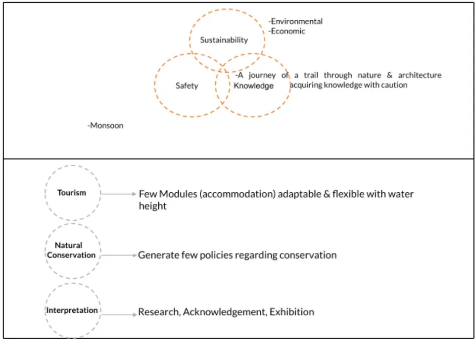
a) Natural Factors
- Natural Site Preservation: The development of the facility should cause as little disturbance to the
surrounding environment as possible. This involves taking measures to protect the native plant and animal life.
Minimal Ground Impact: Impact on the ground should be kept to a minimum, therefore, an elevated approach for building construction is recommended. The principle that "less is more" is adhered to by reducing the building's physical footprint, thereby minimizing disturbance to the land.
Substantial Plantation: Native vegetation should be heavily prioritized for the perimeter plantings. This not only improves the site's appearance but also helps maintain its ecological balance.
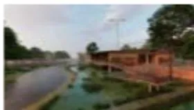
Adaptability to Monsoon Waters: The building design must be flexible enough to accommodate rising and falling levels of water. This ensures that the center can continue to operate without interruption during periods of high inundation (Figure 06).
Beyond Boundary: The whole concept of borders has to be questioned. The center should extend beyond its conventional boundaries to merge with the local ecology, blurring distinctions between the natural and man-made worlds.
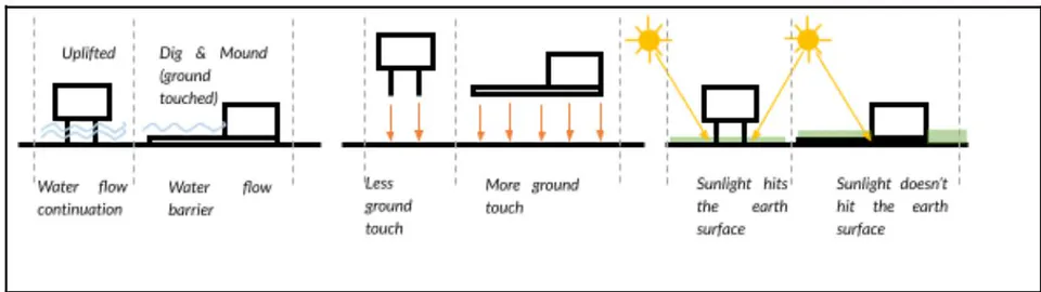
b) Man-Made Factors
- The use of locally obtained materials needs to be promoted as a means to lessen the community's environmental impact and enhance the economy. Utilizing locally accessible materials contributes to the development of a sense of place.
- The center design should prioritize openness and transparency. Visitors benefit from an enhanced awareness of their natural surroundings because of the transparency of buildings that don't block their views (Figure. 07)
- The center's energy plan should prioritize sustainable practices. The carbon footprint of the
facility may be reduced by using renewable energy sources like solar panels and wind turbines.
- Given the variety of uses for the area, careful zoning is essential. The division of spaces should be designed with consideration for both the private functions, like research labs and accommodation, and public zones.
- The design should emphasize the establishment of large open areas that may be used for a number of purposes, including but not limited to, walking routes, Haor (wetland) observation, and bird watching. These spaces should blend harmoniously with the natural surroundings.
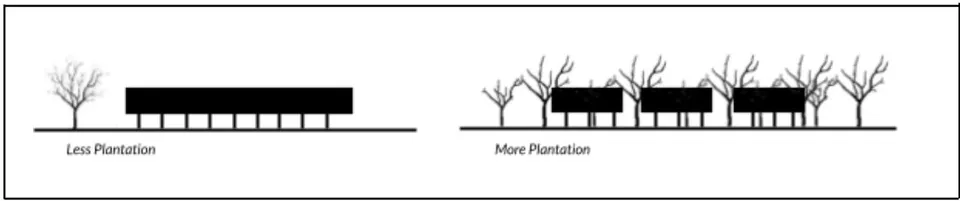
The design of an Eco-System Interpretation Center should be driven by a strong commitment to sustainability, environmental preservation, and the harmonious coexistence of man-made structures and the natural world. Taking these natural and man-made factors into account will make the center an ideal example of eco-friendly architecture and a focal point for spreading awareness about environmental issues.
V. INTERPRETING THE HAOR ECO-SYSTEM: DESIGN PROPOSAL
a) Site Selection for Interpreting the Haor Eco-System
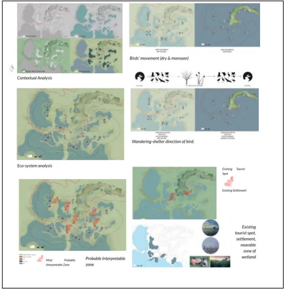
The site analysis and selection of appropriate site for interpretation center has taken into two phases of workout (Figure 08).
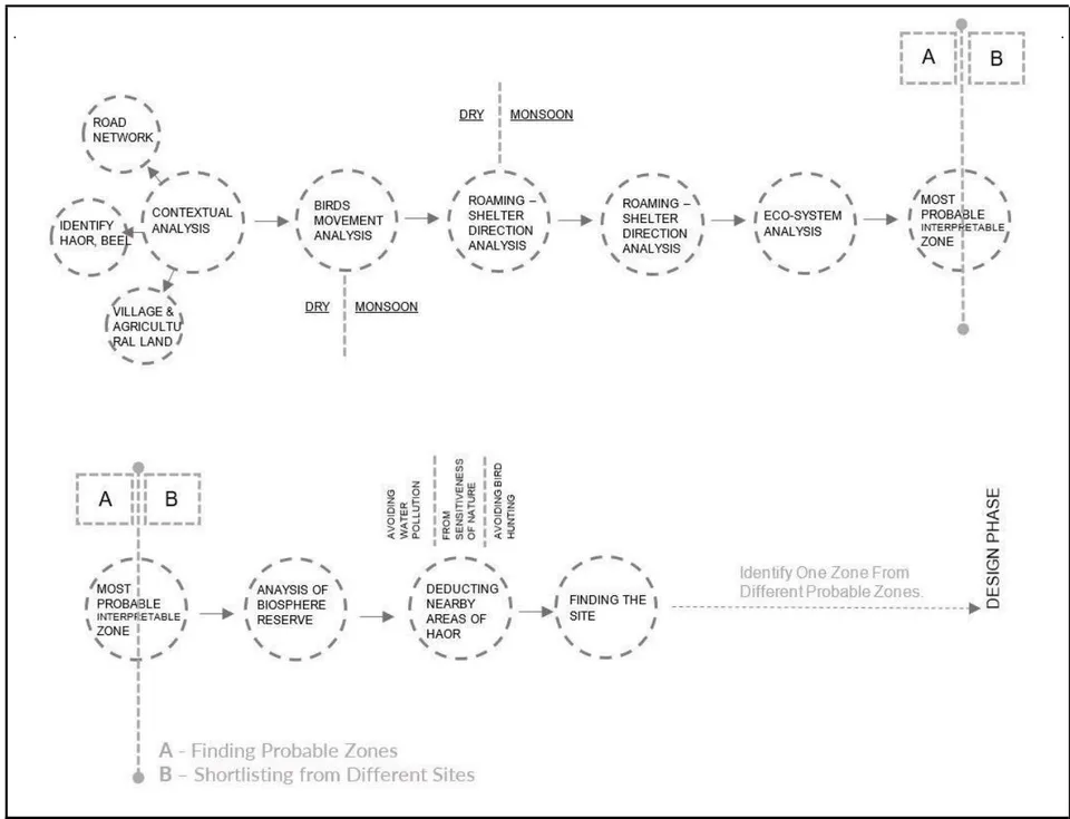
Phase A
Site selection for understanding the Haor ecosystem began with a comprehensive investigation of the surrounding environment. The investigation included a wide range of topics, including road infrastructure, the location of wetlands (Haors), rivers (Beels), and human settlements (villages and towns), and the demarcation of farmland. The road system, topography, and location of settlements in relation to the Haor were all studied in detail. The study helped define areas with distinct features and characteristics.
Detailed research on the habits of birds was also accounted for alongside environmental factors. This required tracking the migration routes and flying habits of different species of birds during the dry and wet seasons. Because of this thorough study, a complete map of the Haor's ecosystem was created. This research established the existence of six separate interpretable zones (Figure. 9).
Phase B
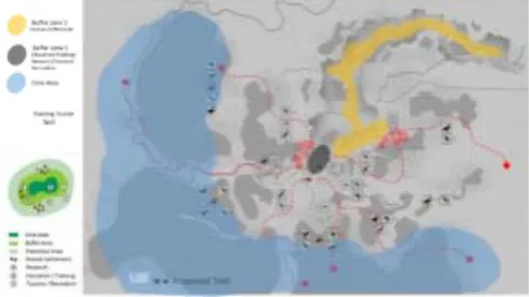
An intensive Biosphere Reserve (Kratzer, 2018) analysis was performed further to narrow down the choices of these six zones. In addition to this study, an examination of the road system, the location of already established tourist attractions, and the finding of communities where birds live without fear despite the presence of humans were conducted. Places that may add to pollutants or damage the wetland's natural environment were specifically avoided.
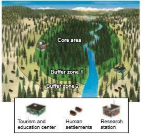
The core area, buffer zone 1, and buffer zone 2 were established based on the principles of the Biosphere Reserve concept (UNESCO 2022). For the purpose of site selection, these labels were placed on the current location. A subset of the first six zones was removed after taking into consideration the road network and the minimal distance from the wetland. The remaining locations were reduced according to their closeness to tourist hotspots and established communities. This decision was made with the goal of minimizing impacts on the local bird population without completely cutting off access to the outdoors and the wetland. In addition to allowing new arrivals to immerse themselves in the natural environment, the selected zones also provided accommodation options alongside the existing ones, thereby minimizing disruption to the birds' habitat and ensuring harmonious coexistence (Figure 10).
b) Program Development
It is crucial to increase public understanding, promote biodiversity, conservation, and ecotourism by creating an eco-nature education and interpretation program for the Haor eco-system. This initiative is focused on educating people about the sensitive biological system that exists in the Haor wetlands in an effort to promote harmonious relationships with the natural world.
From an ecological perspective, tree planting has been regarded a fundamental strategy for many programs. Some trees have been found to offer birds with safe haven, despite their closeness to human dwellings in a hamlet. A large number of well-selected tree species should be planted to improve the environment and offer shelter for birds and fish during the monsoon. Aside from providing security, this reforestation project will improve the local ecosystem.
| Goal | Target | Program |
| To Conserve Eco-systems for Biodiversity | Rehabilitation of Plantation | -Replanting -Enrichment planting |
| Strengthening Co-management | Expansion of Eco-tourism facilities | |
| Wildlife | Protection and management of wildlife | |
| Interpretation Center | Research | Modules adaptable and flexible with the context |
| Acknowledgement |
The Haor Eco-System Interpretation Center's layout prioritizes two distinct areas:
a) Research Lab & Office: This zone is dedicated to the private aspects of the center's operations, primarily for scientific research and administrative functions.
b) Interpretation Center: The interpretation center is designed to facilitate public engagement and education. It encompasses several distinct zones:
- Display Area: The Display Area is a covered indoor place where guests may learn about the Haor
ecosystem. It includes instructional exhibitions, presentations, and interactive media.
- Natural Display Zones: Adjacent to the interpretation center, these outdoor spaces allow visitors to get up close to nature without causing harm to the delicate ecosystem. Careful landscaping and design ensure minimal disruption.
- Education Center (Seminar Room): This climate-controlled space is convenient for holding seminars, workshops, and other learning events because of its close proximity to the lab. It promotes a synergistic
relationship between scientific research and public education.
- Archive: The archive houses a collection of valuable documents, research findings, and historical records related to the Haor eco-system. It serves as a resource for researchers, students, and the public.
- Multipurpose Area: This adaptable area hosts events and activities for a wide range of audiences and may be used for a wide variety of purposes, including but not limited to increasing community participation and events that are in line with the center's objective.
- Small Cafe: A small café provides refreshments for visitors, offering a place to relax and reflect on their experiences while enjoying the natural surroundings.
- Admin Area: The administrative area supports the daily operations of the center, including staff offices and logistical functions.
By including ecological and architectural factors, the designers of this program want to provide a method to understanding the Haor ecosystem that is both comprehensive and sustainable. It aims to educate, inspire, and protect this unique natural treasure for generations to come (Table 01).
c) Concept Derivation
The concept for the Haor (Wetland) Eco-Interpretation Center is based on three primary components. Humanity, rather than being a hindrance to the natural world, is at the heart of the project's overall philosophy. In addition, the idea is formed from a thorough examination of natural patterns with an emphasis on incorporating sustainable characteristics.
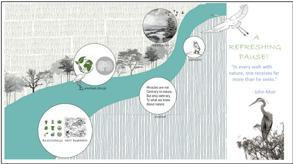
"A Refreshing Pause": The primary concept behind the initiative is to give people a chance to take a "Refreshing Pause." Visitors may take a break from their travel across the major highway via the villages and into the center, which will do them pleasant both mentally and physically. The purpose is to provide a place where people may relax while taking in new information about nature. Eventually, this pause should transform them into blessings for nature, not obstacles, by encouraging an appreciation for the natural world and preventing activities that harm it, such as pollution (Figure 11).
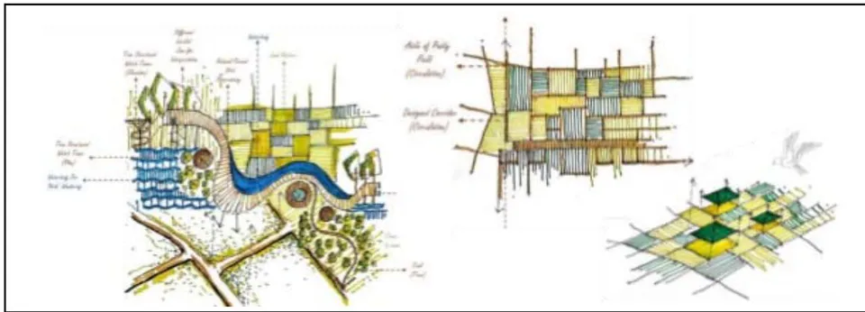
Nature's Language: Another fundamental idea is "Nature's Language." Nature has its own language, which is defined by form, function, and character. Natural land circulation is reflected in the paddy fields and islands that dot the wetland landscape. The design process ought to incorporate the language of nature to ensure that the project blends in with the surrounding environment and does not frighten the birds or disrupt the sensitive equilibrium of the wetland ecosystem. This requires thinking about the interplay between the built environment, trees, and nature, and planting a large number of specific trees like Hijol, Korosh, and Barun to improve the habitat for birds and fish, as well as understanding and reiterating existing patterns (Figure 12).
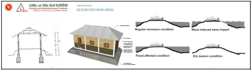
Energy Efficiency and Eco-Friendly Practices: The project is committed to using as little energy as possible and designing eco-friendly indoor and outdoor areas. The use of solar energy, the encouragement of natural ventilation and lighting, and the use of recyclable, reusable, and low-maintenance materials all contribute to this goal. The topography of the land, the ground and surface water levels, the existing flora, and the aquatic ecosystems are all given high priority when it comes to eco-friendly building design. To protect the sensitive ecological situation, human influences are carefully evaluated. Site selection, site planning, architectural design, material selection, and construction processes should all conform to criteria established by institutions like the Housing and Building Research Institute (HBRI) (HBRI 2018) (Figure 13).
Source: (HBRI 2018)
d) Built Form Derivation
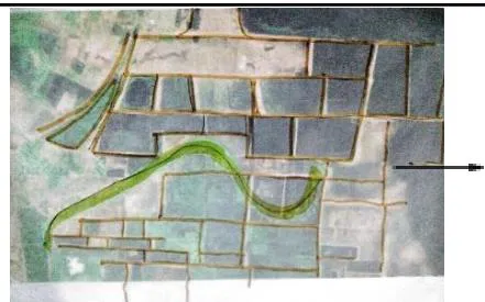
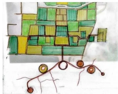
Haor (Wetland) Eco-Interpretation Center design and architectural form are strongly rooted in the language of nature. The shapes, patterns, and lines of nature are all its own. To achieve a design that works in concern with its surroundings, it was essential to investigate and comprehend these natural patterns. To begin, a section of the land was chosen where distinct natural lines and patterns already existed. Schematic outlines, lines, and an overall master plan were built by carefully observing and accommodating these preexisting patterns (Figure 14).
Formal lines that reflect natural geometric forms, such as rectangles and squares, describe the center's formal functions, especially the interpretation center. These forms are both structurally sound and consistent with the conventional roles of interpretation and education.
Curved lines that are more organic and relaxed characterize the more informal uses, such as the bird observatory. These lines are an attempt to capture the fluctuating patterns of a wetland's ecology. These lines' irregularity and fluidity reflect the bird observatory's informal and observant nature, giving visitors an immersive experience that blends with nature.
The Haor Eco-Interpretation Center's architecture is a literal translation of the language and patterns found in nature. Its combination of both formal and informal forms results in a design that not only blends in with its surroundings but also connects visitors to the intricate beauty of the Haor wetlands.

e) Land Use Selection and Master plan Development
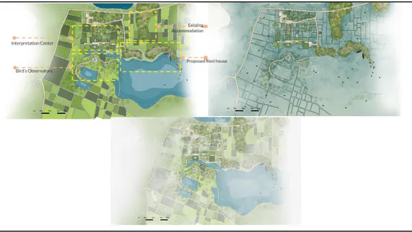
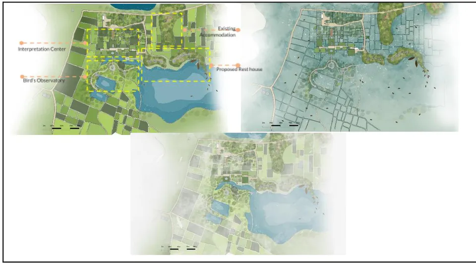
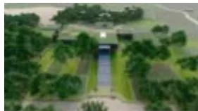
The Haor (Wetland) Eco-Interpretation Center has been built according to a well-thought-out layout and land-use strategy (Figure 15). The major goal was to create a space that could serve several purposes while still being in harmony with its natural surroundings. Three distinct zones (Figure 16) were identified based on the program requirements:
i. Interpretation Center
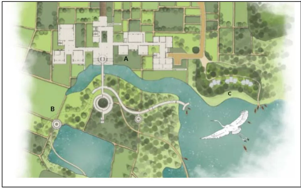
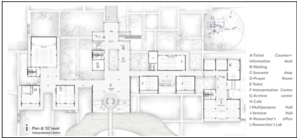
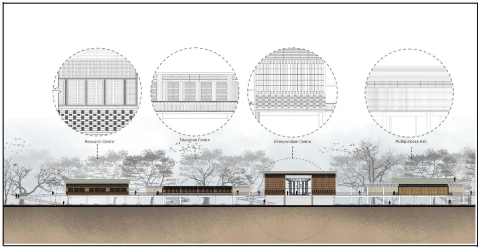
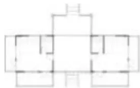
The Interpretation Center serves as the hub for a wide variety of activities. The left side houses the more public areas including the lobby, museum, gift shop, administrative offices, multipurpose rooms, cafe, archive center, and prayer room. On the other hand, the right side of the building has more private and restricted areas such the classrooms, laboratories, and offices (Figure 17 &18).
ii. Bird's Observatory
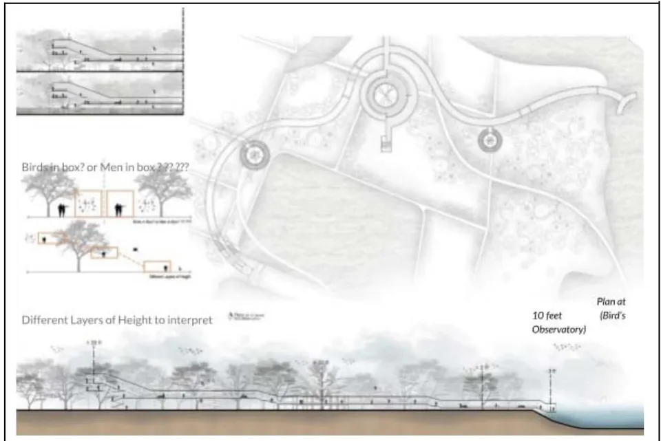
This area is designed with a curved shape to facilitate bird observation. Visitors are guided through a series of progressively higher platforms from which they may get a better look at the feathered inhabitants, both at ground level and from above (Figure 19).
iii. Accommodation
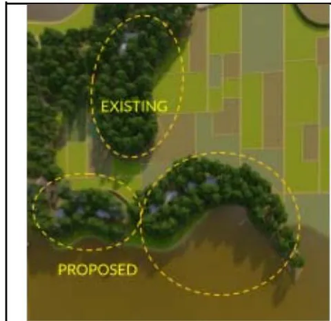
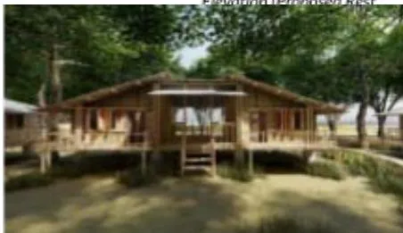
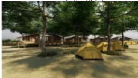
The location of the accommodation zone was carefully chosen to match the preexisting layout of settlements. This method involves constructing tiny buildings amongst hundreds of trees. This design was inspired by local buildings, which give a huge piece of land of trees and a smaller area to the house. This design protects the ecosystem and lets birds travel and rest freely. The planned accommodation follows the "Dig & Mound" style of the existing buildings.
The master plan prioritizes a harmonious integration between the built environment and nature, minimizing the impact of the center on the wetland ecosystem. This method not only pays respect to preexisting structures but also gives visitors an interactive and eco-friendly experience (Figure 20).
f) Eco Sensitive and Sustainable Way of Interpretation
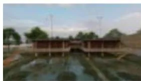
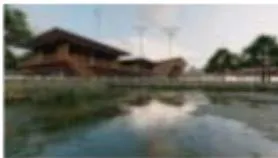
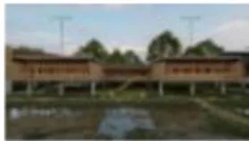
The Haor (Wetland) Eco-Interpretation Center integrates the built environment with the natural environment in a way that is both sustainable and ecologically sensitive (Figure 21).
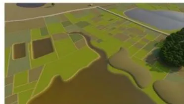
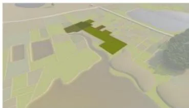
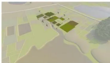
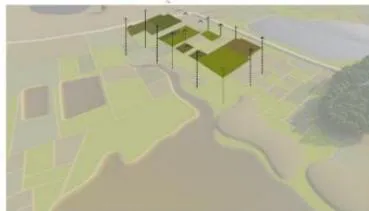
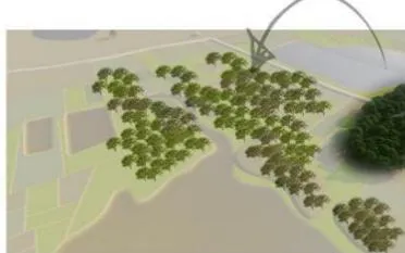
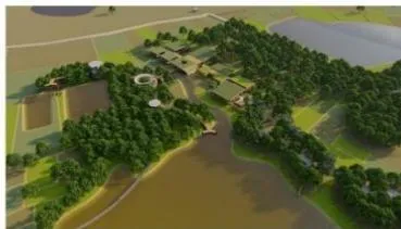
this careful preparation, it is difficult to distinguish between manmade and natural environments. The design purposely blurs the line between plants and nature.
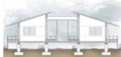
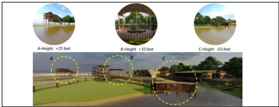
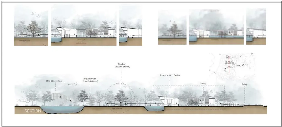
b. Afforestation and Extensive Open Spaces: The need of afforestation is emphasized, and large open areas are provided. Landscaping activities at the facility are vast, adding to the area's biodiversity and providing sanctuary for animals, notably birds and fish during the monsoon. The master plan has extensive landscaped areas, bird-watching platforms, and wetland observation paths. These parts have been thoughtfully included into the layout to provide visitors with an all-encompassing experience that is in harmony with their surroundings. c. Adaptability to Monsoon: The architecture is flexible and adaptive, allowing it to continue functioning even during times of high water, in consideration of the seasonal change in water levels caused by monsoon rains. Because of potential flooding, the whole building has been raised. This height not only allows for more adaptation to shifting water levels, but it also reduces the building's negative impact on the surrounding marsh.
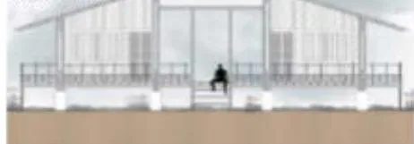
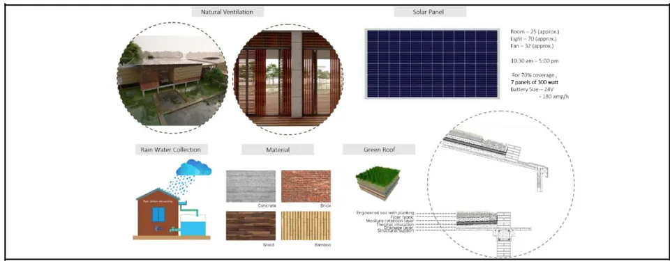
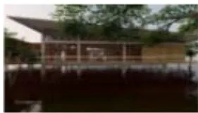
d. Sustainability Measures: Natural ventilation, solar panel systems, rainwater collection, the use of locally produced materials, and the installation of green roofs are just a few of the environmental measures embraced by the center. The center's impact on the environment is reduced because to these efforts (Figure 22). e. Observation With out Disruption: The design offers a fenced experience for visitors so they may observe from a safe distance without disturbing the natural environment. Visitors may attentively look into the surroundings without disturbing birds or destroying the natural ecosystem while traveling (Figure 23). f. Theme - "Birds in Box? Or Man in Box??": The decision was made to enclose people within the "box" to bring them closer to nature and allow them to observe without physical contact or harm. In contrast, the birds are left free in their natural habitat, ensuring minimal disturbance from human activity while enabling them to observe people from a safe distance (Figure 24).
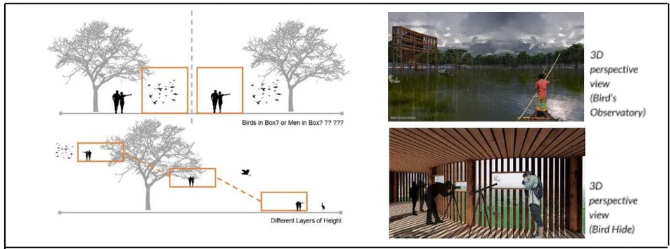
The Haor Eco-Interpretation Center takes an approach to interpretation that places an emphasis on ecological consciousness and harmonious coexistence with nature. The birds are permitted to thrive in their natural setting, while visitors are kept safe inside a controlled atmosphere intended to safeguard the wetland's sensitive ecology.
g) Environment Friendly Materials use
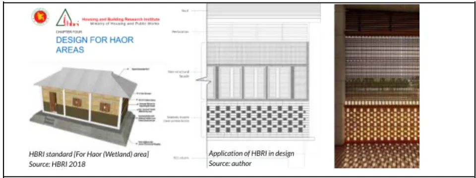
The Haor Eco-Interpretation Center's materials for construction were carefully selected to minimize their environmental impact and to correspond to the standards set out by the Housing and Building Research Institute (HBRI), Ministry of Housing and Public Works, in particular Chapter 4, "Design for Haor (Wetland) Areas" (HBRI 2018).
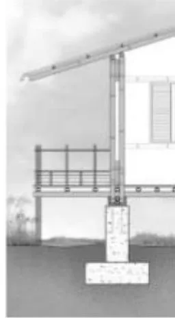
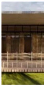
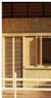
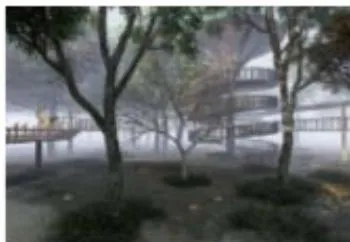
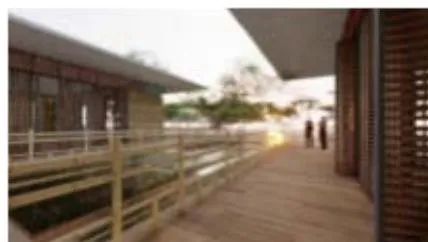
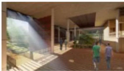
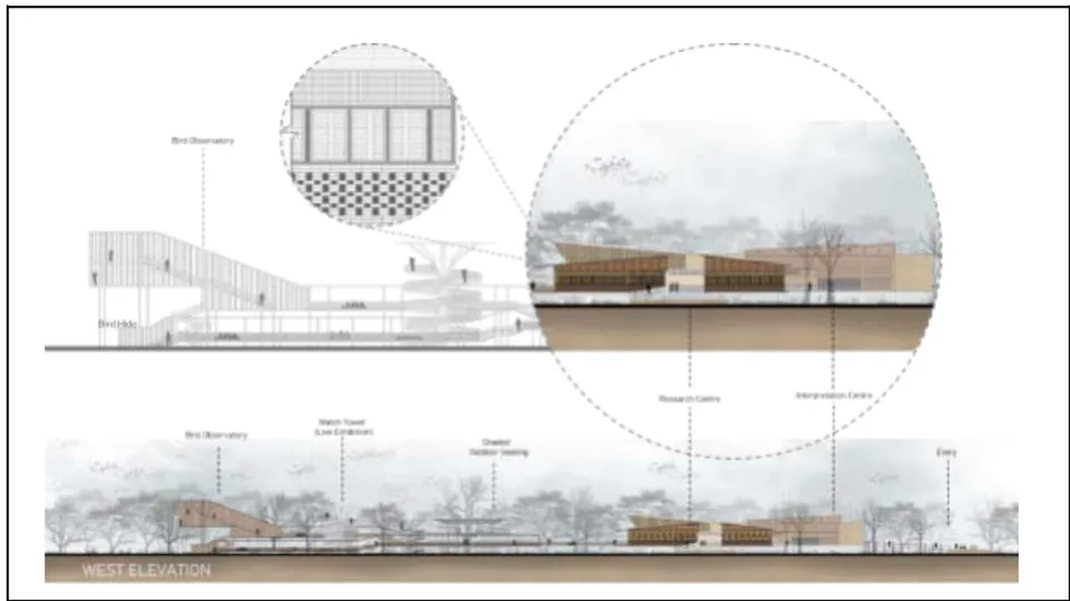
The plinth is stabilized with cement or Ferro cement wrapping as per HBRI specifications. This type of stabilization guarantees long-term viability and resilience in a wetland setting. FC Hollow Columns or RCC (Reinforced Concrete Columns) are used to create the building's column framework. These materials are both environmentally friendly and give structural stability. The top part of the walls is a non-structural façade, while the bottom part is meant to be individually replaceable, as per HBRI rules (HBRI 2018) (Figure 25). This kind of design makes maintenance easy and has a little ecological footprint. Perforations in the top portion of the walls, starting at a predetermined level and running all the way down to the bottom of the slab, are an innovative feature of the standard. The excessive humidity in the area is reduced due to the strategically placed perforations, making the environment more pleasant for everyone (Figure 26, 27).
h) Experience with Seasonal Variations
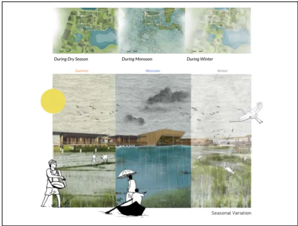
The Haor (Wetland) Eco-Interpretation Center is an interesting year-round attraction because of the extensive seasonal changes that occur on-site and in the surrounding area. These seasonal variations are integral to the center's experience with conscious considerations.
The landscape becomes covered in vibrant colors of green during the pre-monsoon season (April to
May) when paddy fields shine in the summer light. There are many colors of green and yellow all around, making for a really attractive scene. The center takes on a different look during the monsoon season (June to September) due to the heavy rains. Visitors may explore the location in non-motorized boats as the architecture seems to float on the water. When water levels rise dramatically, visitors may see underwater activity because of a section of the museum built at a lower level.
The results of the rainy season are still visible in the months after the monsoon (October-November). As a result of the previous rains, the wetland area is constantly evolving. The marsh area becomes a sanctuary for migrating birds during the winter months (November through March). These magnificent birds populate the area, providing a beautiful spectacle for tourists.
The changing seasons are a visual and sensual feast from every perspective point, whether from above or below ground or within man-made buildings. The summer's vibrant colors, the monsoon's floating structures, and the winter's birds demonstrate each provide their own unique and fascinating spectacle. Visitors to the Haor Eco-Interpretation Center may experience the genuine essence of these seasonal changes both within and outside the buildings (Figure 28, 29).
VI. CONCLUSION
The Haor Eco-Interpretation Center is an important step forward in the goal of raising environmental consciousness and educating locals and visitors. This endeavor is necessary for the long-term health of the adjacent wetland ecosystem, which includes the delicate equilibrium of wetlands, aquatic life, abundant flora, and diverse fauna.
Hakaluki Haor is a tapestry of tourism, research, and knowledge, embracing its ever-changing ecosystem and attractive changes in seasonal landscapes. Due to the dynamic nature of the surrounding natural fluctuations, architectural and natural features must be carefully considered throughout the design process. It stresses the need for careful site selection, no hard lines, and little disturbance of the soil.
Ecological considerations such as monsoon-induced water fluctuations, seasonal changes, avian behavior, existing site character analysis, zoning insights, humidity mitigation, local material integration, and adherence to local standards like HBRI are all addressed in this project, making it an outstanding example of eco-sensitive design. The ultimate objective is to minimize environmental impacts, harmonize the existing land pattern, and encourage extensive reforestation.
This project emphasizes the need to preserve and protect our natural habitats via careful planning, thorough planting, and skilled construction. The journey from site selection to sustainable design serves as an example of the potential of creating harmonious, eco-conscious projects that embrace both the natural world and human innovation.